I had a very bad day. Poor planning, plus bad circumstances. Too tired to write good text. I’ll just post the pictures, and illuminate later. Maybe you can figure out what’s going on. Note: I didn’t take a picture of all the bad stuff that happened.
EDIT: captions added 23-APR-2017
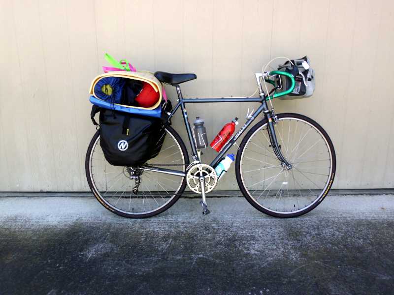
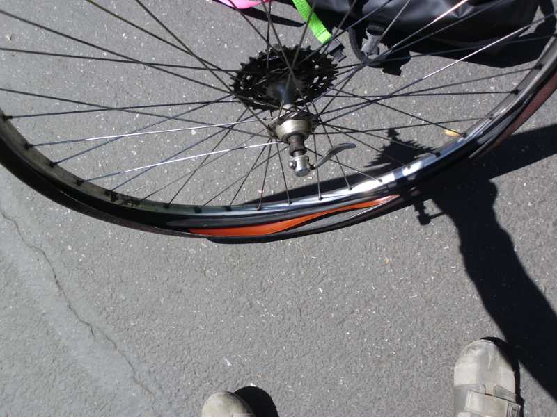
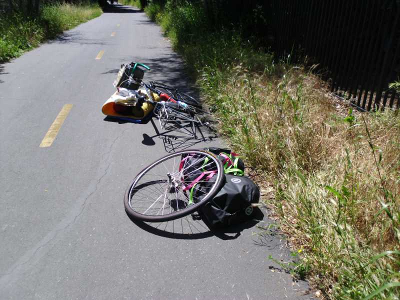
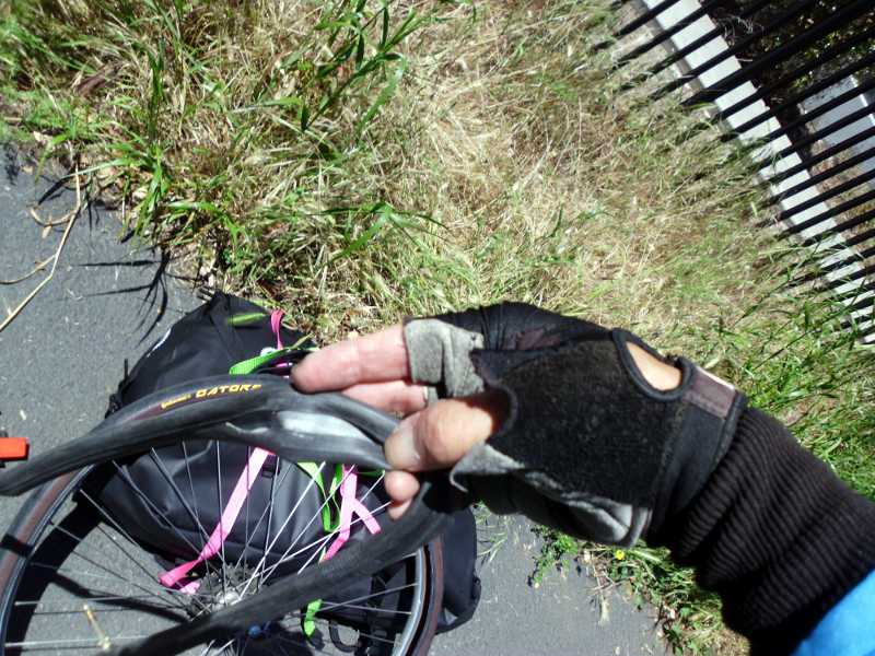
All ready to head out. I was hoping to leave at 10 am, but catching up with email and going through the final checklist took until 1 pm. Still okay, It was “only” 40 miles to the campground, designed as an easy first day. The red can is stove fuel, and the other two bottles are water. The tent and sleeping bag are rolled into the pad, and strapped on top of the blue tarp. This didn’t work out too well – the tent and sleeping bag flew off 3 times, no matter how much I tightened the straps. One time they almost went down a 20-ft embankment into the river below.Not 6 miles out, on the Los Gatos Creek trail, I heard what every cyclist dreads. POW!! Psssss…Oh, it had to be the rear, that means taking everything off. I’m proud that I did not swear once during the incident.Yeah, it’s bad. I had two spare tubes, originally, but used the first one to replace a blown tube on the front tire. Had to use the last remaining spare here, meaning I would be running without a spare until I could buy some. That’s what I get for using 7-year-old tubes that were just lying around in the garage. What a fool I was!
I was using printed Google Directions (for bicycling). That’s not the best way to do it. Their directions are designed for GPS, so involve a ton of little turns, and streets to watch out for. I also found that since my smart phone wasn’t activated, I could only get general maps of the area, not detailed ones. After missing the Hwy 87 bike path, I looped for an hour in San Jose, trying to find it. Finally, I asked someone at a Wendy’s how to get to Curtner, which was one of the later points on the directions. He pointed me to Monterey Rd, which I should have just stayed on all the way to Morgan Hill. But I went onto the Google recommended bike trail, instead.
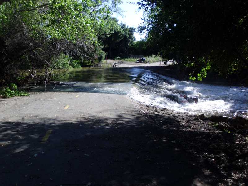
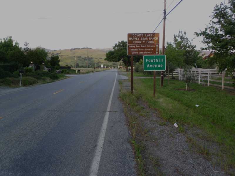
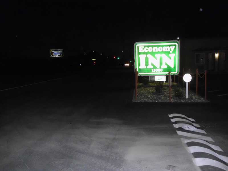
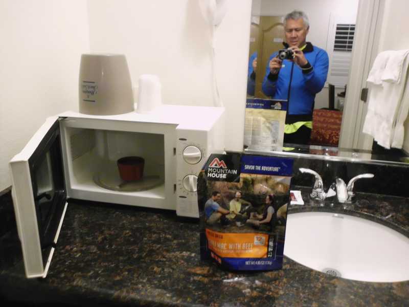
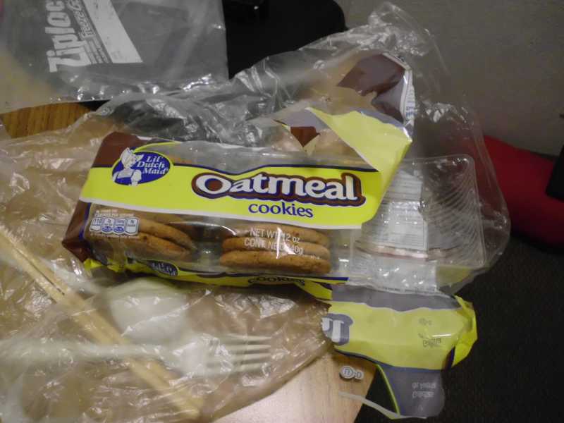
The trail was flooded. I went around on surface streets, and kept running into more flooding. A man on the trail told me how to bypass the flooded area, which I did, but 5 miles later, the trail was closed.Okay, so I made it to the entrance of Harvey Bear / Coyote Lake park. It was almost sunset. There was a sheriff there, so I asked where the campground was. He said it was a 4-mile steep climb to it (see that peak in the distance?) I decided to head back to the Motel I had seen 4 miles back on Monterey Rd.I was in my granny gear fighting strong headwinds back to the motel. It was getting dark by the time I arrived – not as dark as when this picture was taken later. I realized that the nearest food was at least 2 miles further up the road in the dark. Hard to walk, and not great on a bike, either, considering winds.Economy, all right. $99, no continental breakfast – in fact, not even coffee in the lobby. No coffee in the room. Fortunately, I was able to microwave water, and hydrate my single emergency meal. So now, I had lost spare food, too, I’m still grateful for the motel, as there really was no other option in a suburban area other than troubling friends.In my effort to make schedule, I didn’t eat lunch, and just ate cookies and drank water while riding. Didn’t eat that many, either.
Miles for day: 48.9
(Visited 149 times, 1 visit(s) today)
a patch won’t fix that one. how did you do that? oatmeal mmmm! Good nite!
I had to just use my only spare tube, leaving me with zero redundancy. The jungle fix is to tie a knot in the tube around the afflicted area, and inflate to low pressure. Bumpy and perilous ride, but it might get you to the next town.
Thanks, Marilyn! I was actually considering giving up, or calling in for a ride on that first day. It was supposed to be an easy day, but everything went wrong. I’m glad that people are praying for me. Each day, I seem to make it – just barely.
You’ve local friends who’re glad to head over and lend a hand — and tool s and inner tubes. I hope YOU are whole and well. You are much harder to repair!
This is sort of the shake-out ride before the actual Southern Tier begins in San Diego. It’s better that I learn the hard lessons now, instead of in the desert. It’s comforting to know that I could call in if I had to, though.
I think I’ve enabled my Android to report location. Could you show Merrianne how to track me on Google Maps? It won’t always work, because I’m going to be out of cell and internet range sometimes (like the last 2 days).
Argh! What a way to start a trip. That river running over the road looks impressively strong. Hope it didn’t wash you out! Did you have to walk it? Praying for you to have a better day today.
It’s worse than it looks. 6 feet deep on the trail in places. Impassable, so I had to go up onto surface streets. Then I got back down onto the trail, and there was another rapids across the trail in a quarter mile. But it got worse. Will write about it later.
Thanks, Janet. Too much adventure, if I had my druthers. I don’t think I could have made it even this far without prayers. I’m thankful that the Motel was there, for example, and not further back into town.
a patch won’t fix that one. how did you do that? oatmeal mmmm! Good nite!
from Ubuntu 17.04, a 2.5 hour upgrade from 16.10
I had to just use my only spare tube, leaving me with zero redundancy. The jungle fix is to tie a knot in the tube around the afflicted area, and inflate to low pressure. Bumpy and perilous ride, but it might get you to the next town.
Sorry that you had such a bad start!
Hopefully this is the worst that will happen, and it will all be smooth riding from here.
Thanks, Marilyn! I was actually considering giving up, or calling in for a ride on that first day. It was supposed to be an easy day, but everything went wrong. I’m glad that people are praying for me. Each day, I seem to make it – just barely.
You’ve local friends who’re glad to head over and lend a hand — and tool s and inner tubes. I hope YOU are whole and well. You are much harder to repair!
This is sort of the shake-out ride before the actual Southern Tier begins in San Diego. It’s better that I learn the hard lessons now, instead of in the desert. It’s comforting to know that I could call in if I had to, though.
I think I’ve enabled my Android to report location. Could you show Merrianne how to track me on Google Maps? It won’t always work, because I’m going to be out of cell and internet range sometimes (like the last 2 days).
Argh! What a way to start a trip. That river running over the road looks impressively strong. Hope it didn’t wash you out! Did you have to walk it? Praying for you to have a better day today.
It’s worse than it looks. 6 feet deep on the trail in places. Impassable, so I had to go up onto surface streets. Then I got back down onto the trail, and there was another rapids across the trail in a quarter mile. But it got worse. Will write about it later.
Wow, so much adventure on just the first day! That waterfall over the road was something else.
We are thinking of you and praying with you Roderick!
Thanks, Janet. Too much adventure, if I had my druthers. I don’t think I could have made it even this far without prayers. I’m thankful that the Motel was there, for example, and not further back into town.