Lockport, NY

July 21, 2010 7:46 pm

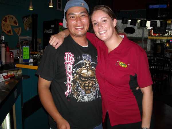
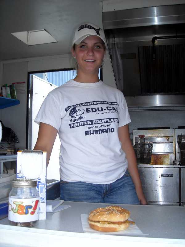
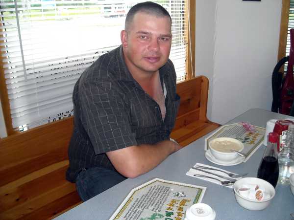
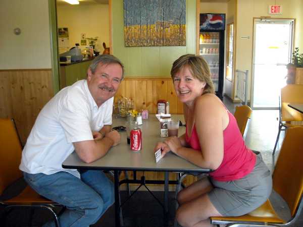
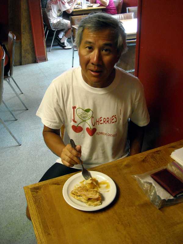
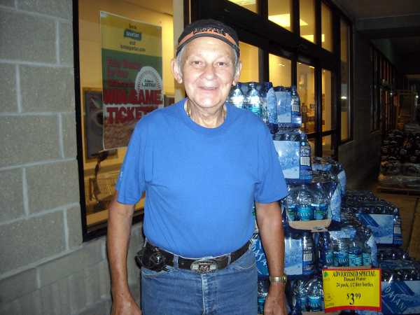
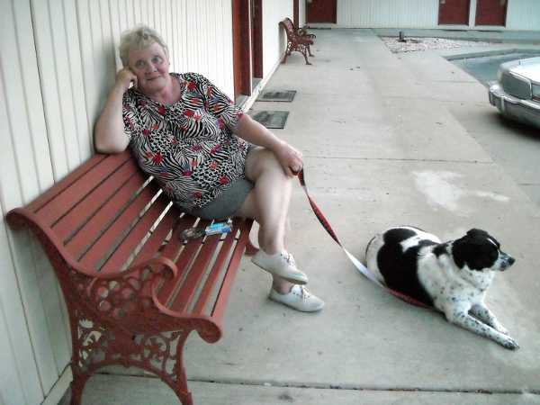
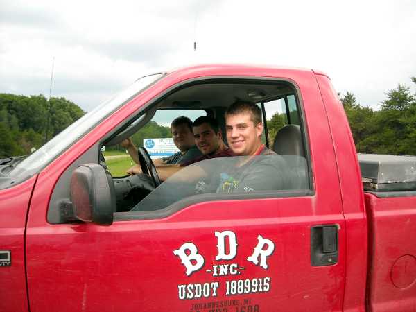
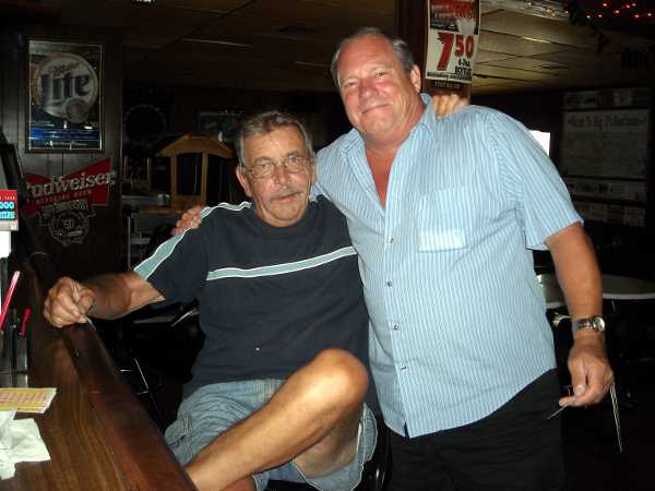
This morning, we set out looking for the Dad’s diner recommended by Milica had recommended. We got lost, but the gentleman below helped us out. BJ turned out to be a former cook at Dad’s, but had moved on to a well-known Italian restaurant in town. He said that the restaurant was a hole-in-the-wall, and doesn’t even advertise. It used to be called Simon’s. Not only did BJ give us directions, he walked almost two blocks with us to show us the way. He was supposed to be married on the 18th, but had to go to court, instead. We wish him well.
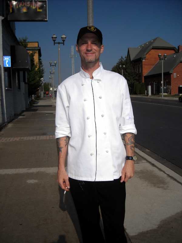
DSCN0903s.JPG

BJ

DSCN0904s.JPG

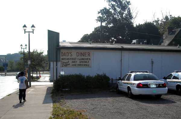
Police cars outside, a good sign.

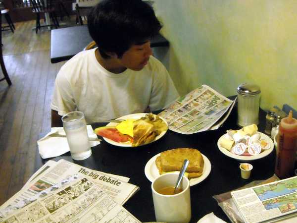
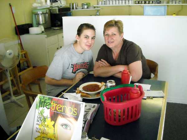
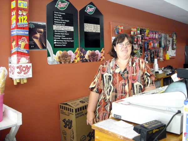
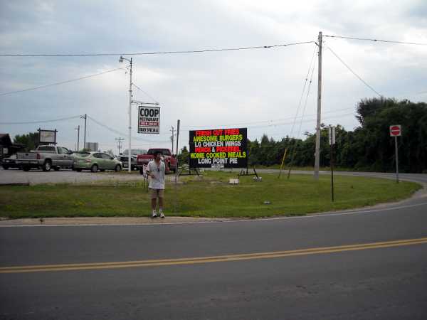
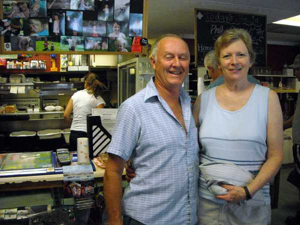
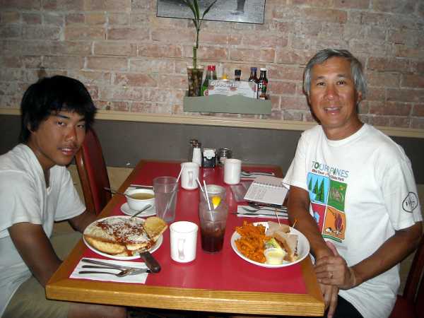
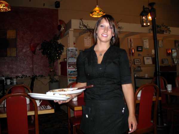
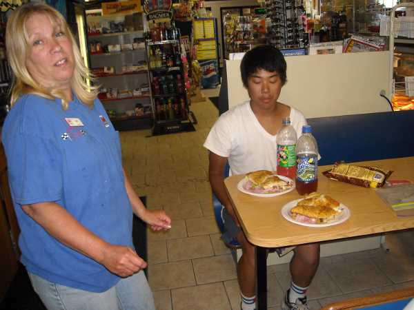
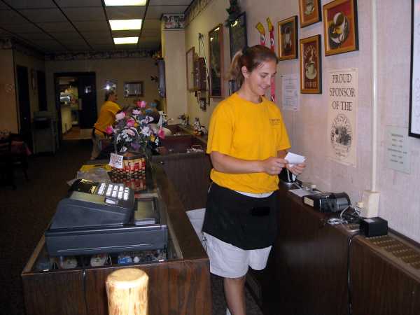
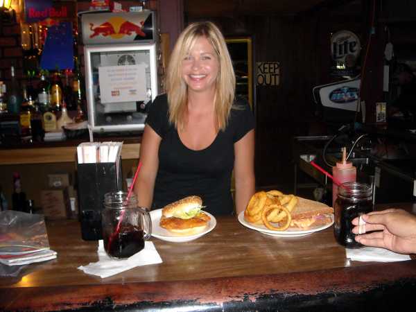
Dad’s was an unassuming place with good prices. There was construction going on nearby, and the construction workers were coming in to order things. Our server, Janice, was always on the move, but never too busy to smile or ask how someone was doing.

DSCN0906s.JPG

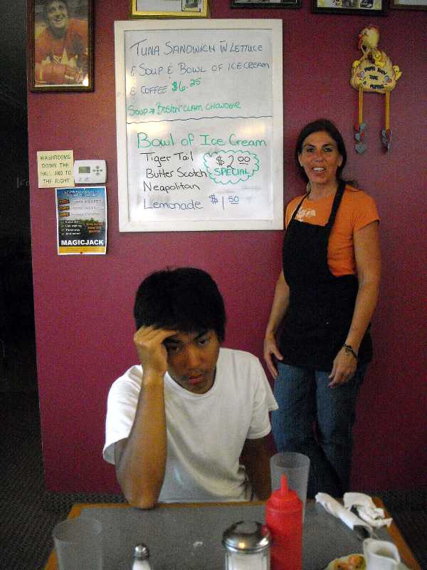
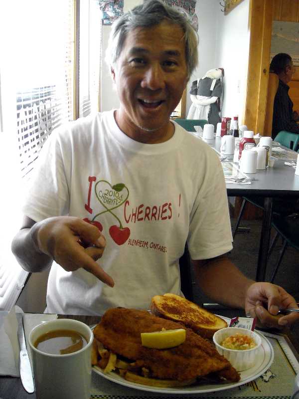
In spite of the bustle, Janice agreed to pose by the sign. Look at the price of the complete lunch, and remember, these are Canadian dollars. Elliot had trouble finishing all his french toast, so Janice gave us some tinfoil to wrap it.

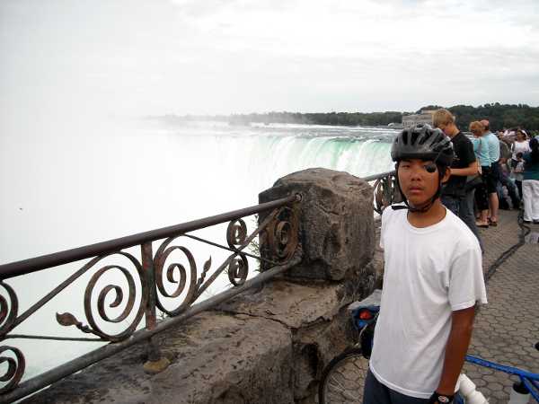
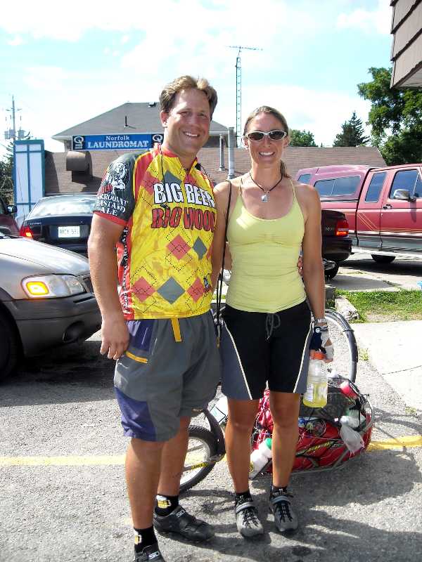
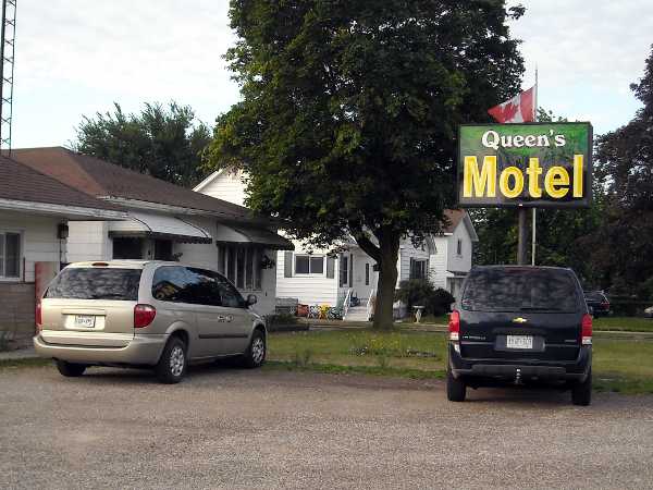
We went back to the Motel, and were right on schedule to check out before 11, but I got caught up visiting with Ray and family. I’m pretty sure he said his name was Ray, because I spelled it out to confirm, but when I checked their website, it said Rod. It was intended to be a short day, anyway, because we wanted to ride the Maid of the Mist, a once-in-a-lifetime experience, at least for me. Perhaps Elliot will get to do it again, if he has children someday.

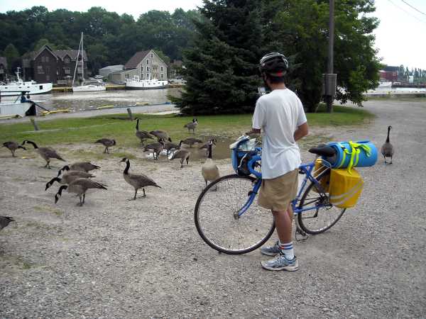
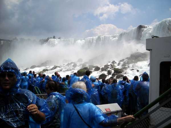
The Maid of the Mist (MM) was very reasonably priced – $15.60 Canadian per person. We got rid of our Canadian cash, leaving less than a dollar to carry back. No reservations necessary. We snaked our bikes down a maze of ramps with the rest of the cattle, and took elevators down to the dock. As even wheelchairs are not allowed aboard the MM, we parked our bikes on the dock where people put their strollers, and took our valuables in our front packs with us. I judged the risk to be low, as the only people on the dock were the staff and those who had paid to ride the MM.

DSCN0913s.JPG

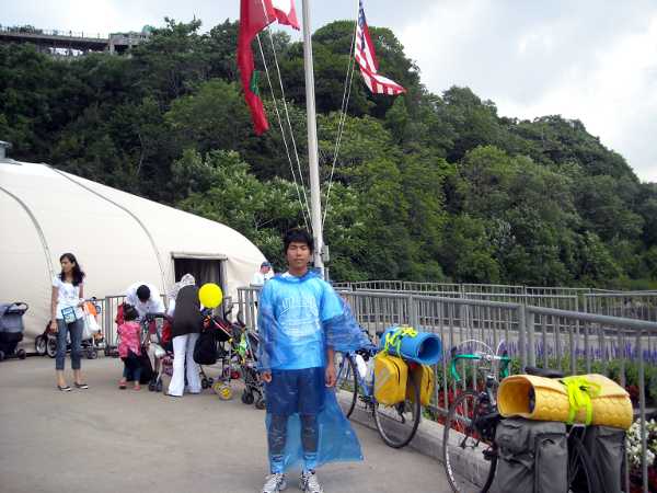
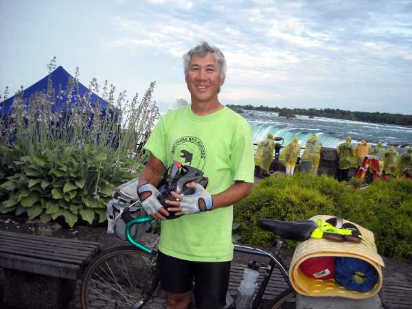
Elliot in the standard MM poncho. It was a hot day. I decided not to use the poncho.

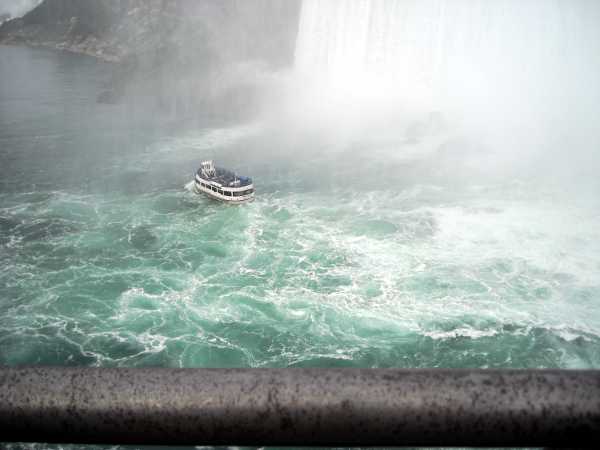
We just missed the boat as it was leaving (there are like 6 of them, I think), but that only meant we were first in line for the next boat, and got the best spots on top deck, starboard side.

DSCN0921s.JPG

The American Falls. Our guide told us that the rocks fell in a spectacular collapse 50 or 60 years ago. I wonder if my mother and father saw a different falls when they visited Niagara on their Honeymoon?

DSCN0930s.JPG

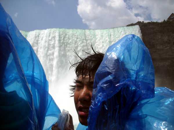
Ladies and gentlemen, this IS Niagara Falls!

The MM is totally worth it. There are about 6 other major attractions relating to the falls, but if you see only one, I recommend this one.

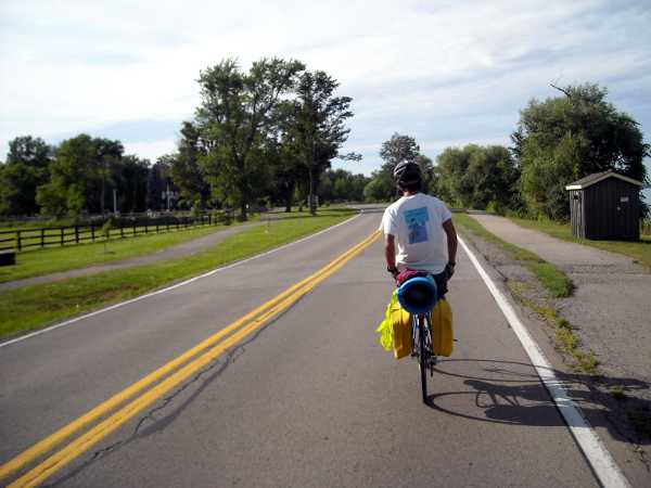
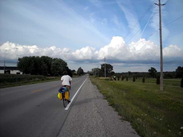
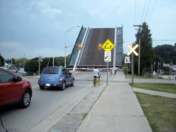
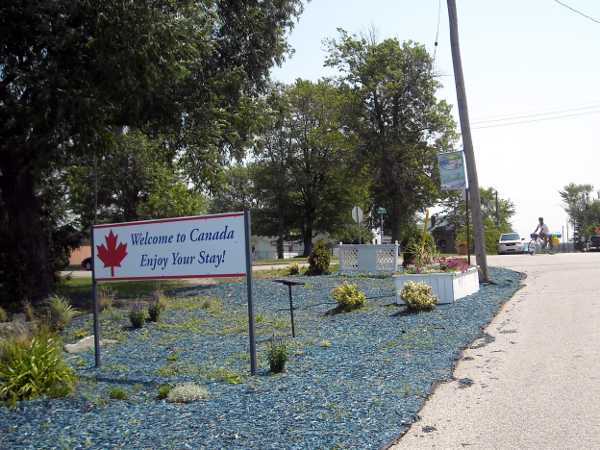
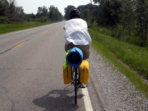
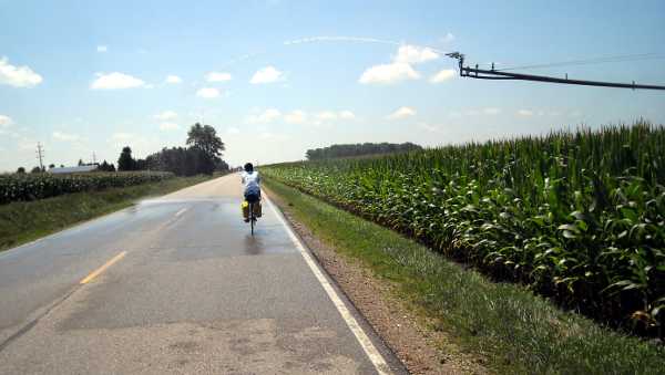
Instead of taking the obvious Rainbow Bridge, the Adventure Cycling route went over the Lewiston Bridge, and said to ride with the traffic. It was a long, circuitous approach to the bridge, perhaps 5 to 7 miles. I’m not sure why there wasn’t a more direct path. We got to this highway entrance below, and I struggled with whether the sign meant no bikes, or no walking your bike. I decided it meant the latter, and trusted Adventure Cycling.

DSCN0933s.JPG

DSCN0934s.JPG

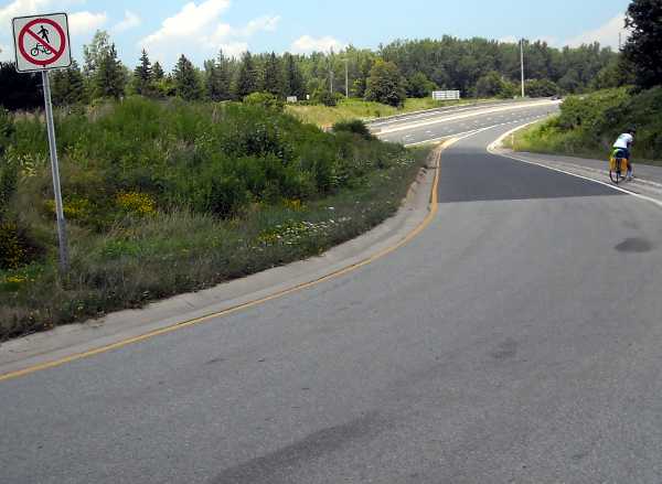
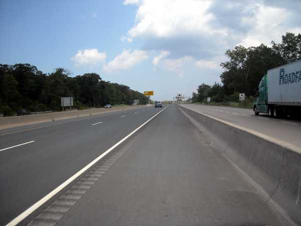
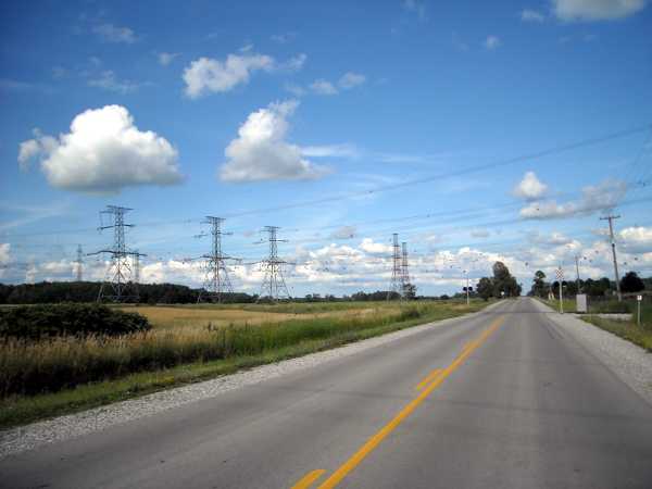
The highway was actually very lightly traveled, and had a wide and smooth shoulder. Absolutely fine for bikes.

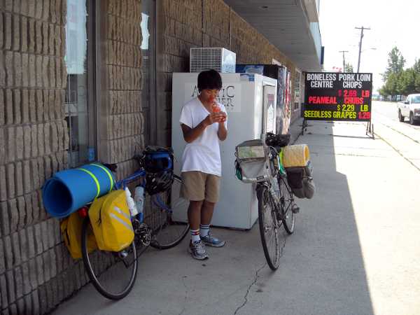
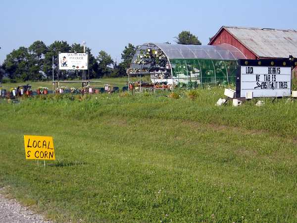
My plan was to stop at the first restaurant once we crossed over into New York, but we saw none for miles and miles. This fruit stand was the first food we encountered.

DSCN0937s.JPG

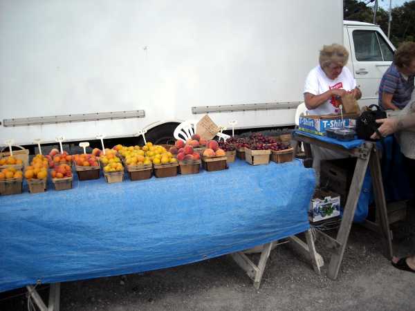
We got a basket of apricots for $1.35

DSCN0938s.JPG

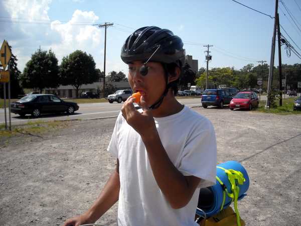
They were good, we each ate about 3 on the spot.

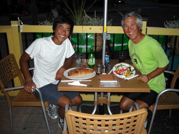
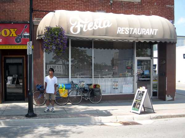
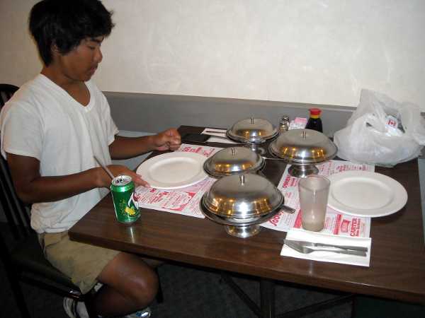
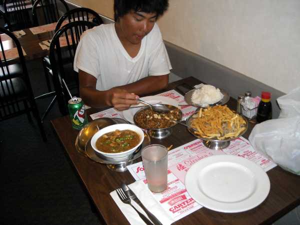
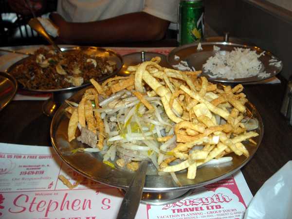
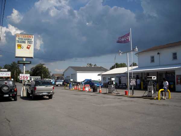
We passed through the Tuscarora Indian Reservation, and had lunch at this place. A full size Philly steak was $8, with no tax. We each had half; it was large. The meat was shaved thin, not like the Roast Beef slices that many places in California puts on a bun and calls cheese steak.

DSCN0939s.JPG

Around Cambria, there were some girls selling lemonade. It was a mandatory stop.

DSCN0941s.JPG

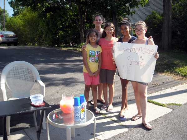
The girls are all cousins, except for the tall one, who is the mother of two of them.

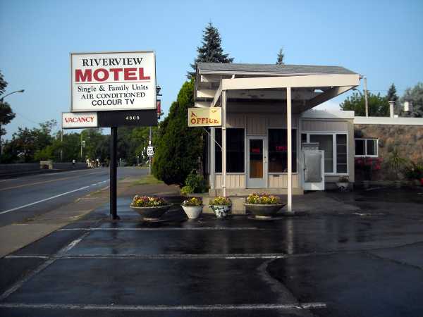
In Lockport, we had trouble finding the motels, but with the help of locals, located some. We’re staying at the Comfort Inn. I had hoped for a first floor room, but the woman at the desk said that all the non-smoking rooms were upstairs – they liked to segregate them from the smoking. Nevertheless, on the way to room 286, we went through a corridor of non-smoking rooms on the first floor, with “no smoking” plaques firmly affixed to their doors. I would have preferred that the desk clerk simply tell me that there were no more rooms available on the first floor. The facilities were nice, but not a good value for the money, at over $100 when tax was added.

Elliot wasn’t very hungry, so we simply heated the soup we bought previously in the room’s microwave. I went to the laundromat to attempt washing our clothes, but found that the place closed at 9 pm. Right next to the laundromat was Mighty Taco, so I got us some supplements to our dinner.

Mileage: 44.4

Niagara, ON

July 20, 2010 11:49 pm

DSCN0868s.JPG

This morning, we went back into downtown Dunville and had breakfast at the Flyer Cafe.

Bev and Marc, if you’re reading this, did you stop at the Flyer Cafe in the morning? If not, you missed out on the pies!

DSCN0870s.JPG

Homemade pie selection.

DSCN0871s.JPG

The cafe looked like a converted drugstore. Note the lower left drawer.

We had an easy ride to Port Colborne. The first restaurant we saw there was the Surfside, and it was our lunch stop.

DSCN0872s.JPG

DSCN0874s.JPG

This was in the corner of the restaurant. It's what the Riverside Motel needed.

The owner was Debbie, and Cheryl (Cheryl-Lynn) was working there, too. They seemed familiar with each other, so I asked if they were mother and daughter. No, but Cheryl is a potential future daughter-in-law. I asked Debbie whether bikes were allowed on highway 3, and she said she didn’t know. She said that the bike path was paved, but she didn’t know how to get to it.

By coincidence, when I was at Kaimuki Intermediate School, the two cutest girls there were a couple of sisters – Cheryl and Debbie H. Eric O., do you remember? So I was compelled to take Cheryl and Debbie’s picture.

DSCN0876s.JPG

Cheryl and Debbie

We couldn’t find the bike path listed on the adventure cycling map, so ended up taking highway 3 straight into Fort Erie. It was a straight shot, and bikes were fine on the road. At Ft. Erie, after a bit of searching, we turned left onto Niagara Blvd, which eventually became the Niagara Parkway. There was a bike path to the left of the street. It was paved, but I found it bumpier than the road, and there were joggers and slow bikes on the path. Traffic was very light – perhaps because of the speed limit of 40 to 60 km/h on many parts of this road.

DSCN0881s.JPG

Niagara Parkway, with bike path to the left.

At the falls, someone was filming a movie or something. There were production trucks lined up on the street, and the best viewing area was cordoned off. We still got some pictures in. Elliot took videos with his flip.

DSCN0888s.JPG

DSCN0894s.JPG

DSCN0891s.JPG

This is one of the Maid of the Mist boats below. We want to try to take that tomorrow.

There were tall skyscraper motels near the Falls, but the Adventure Cycling map said there were other places up the road further. We continued on River Road, and after passing dozens of B&B’s (no vacancies), came to some motels. The first we saw was the Riverview Motel (not to be confused with the Riverview in Dunville).

DSCN0901s.JPG

The ground is wet from a brief rain. It dried within minutes.

I had already prepared myself for outrageous rates. If the motel at Long Point was $139 for a 1-bed room, then the Honeymoon Capital of the World would surely be high. We pulled in and met Milica (mi-LEET-za) and her daughter Mira, Serbs from the former Yugoslavia. Mira was a school teacher, I think middle school. The next day we met Ray, the father. They had another daughter who was an RN in Toronto.

DSCN0909s.JPG

Milica, Mira, and Ray

They gave us a map, and recommended places in town for food and sightseeing. We could walk to Queen street around the corner for dinner – they mentioned a Bistro, Grill and a Pizza place. Dad’s (Simon’s) was where the locals went for breakfast.

DSCN0907s.JPG

Shoes were kept stored on a rack in the office. A very good sign for someone from Hawaii

The room was excellent! No smoke smell, and no flies. Wi-Fi. And it had towels, lots of towels (remember, this is the Honeymoon Capital). Did I mention it was only $65 for a 2-bed? They had a 1-bed at $55, but the price was so reasonable, we took the larger room. Cyclists take note! This is the place.

We walked down Queen street for dinner. The Bistro was closing up as we passed. In fact, all the stores were closed except some restaurants. A couple blocks down, we came to an intersection. Sports bar on the right, Pizza place on the left. The sports bar looked noisy. We went to the pizzeria. I’m glad we did.

Elliot had a panzarotti, which was a good size pepperoni pizza folded over into a pocket, for less than $5. I had a large Greek salad, which actually had fancy greens in it. It was what my body needed. We also got a couple pieces of bruschetta.

DSCN0898s.JPG

That's Amore Pizzeria

At the bar, a man asked us about our trip. When we said we were from California, he said he used to live in South Central (Los Angeles). Omar Hernandez was originally from Guatemala. He and his family had to pay a coyote to sneak them across the border. Running through sewers, avoiding helicopters, the whole crazy thing. He got caught the first time, but succeeded the next. He was there during the LA riots (note his T-shirt). Now a Canadian citizen, he works in recycling and amusement.

DSCN0897s.JPG

Omar and our super-friendly server, Jill. No, they're not together. I don't think. They do kind of look alike...

DSCN0900s.JPG

Jill took this picture of our big meal.

Mileage for the day: 62.3

Dunville, ON

July 19, 2010 7:04 am

Yesterday, we left the AtPlay Resort at 10:40. It was a rare chance to do computer tasks with a good internet connection. Wireless internet is somewhat more rare in Canada, it seems. We rode back through Port Rowan and immediately saw two possibilities for breakfast: the Moose Cafe and the Sunrise Cafe. Elliot picked the Sunrise. It was on our side of the street, but it also sounded like a breakfast place. It was past noon by the time we got out.

The first part of the day’s ride had a lot of short but steep hills, some up and down, and some only up. I should have taken some pictures, but the last thing on my mind was getting the camera out while standing in my granny gear.

It was 1:30 pm by the time we reached Nomandale. There was a restaurant next to the store, but we just got ice cream. We ate our ice cream in the store, and I had a pleasant time talking with Sharon, the proprietor. She said that the snow gets maybe a foot deep in the winter. I was surprised that it wasn’t more, but I suppose Lake Erie moderates the weather. She said there were a lot of raccoons in the area, and the occasional wolf, but no bears.

DSCN0852s.JPG

Sharon

By 3 pm, we reached Port Dover, one of the larger towns. There was a combined Mac’s/Subway there, and we had lunch. Mac’s is a convenience store in Canada, not McDonald’s. I had a chili cheese dog for 99ยข, and Elliot got a footlong Meatball Marinara sandwich for $5. We also got two 950 mL Gatorades for the road, since it would be 18 miles to Peacock Point, the next place with food. There was no washroom at the store, but the laundromat next door had one.

As we were pulling out from the store, we saw a couple on bicycles pull in. I wasn’t sure whether they were touring, because neither had panniers. The guy was pulling a small trailer, but the woman had only a handlebar bag. No camping gear. Marc and Bev were from Colorado, but had started their tour from Seattle, going all the way to Maine. Using ordinary maps, they had planned their route to connect with friends along the way. Mark said they had shipped their bikes to Seattle – both for about $200. I think we’ll do that on the way back – the airline fees are horrendous. They have a blog at http://pieaday.blogspot.com/ , take a look!

DSCN0854s.JPG

Marc and Bev

DSCN0856s.JPG

It turned out that we had the same destination for the day – Dunville. Marc had a regular highway map, and it showed a straight shot to Dunville via county road 3 from Nanticoke. I was sick of the coastal up-and-down, so decided to do the same. We left before them. On the way out of Port Dover, there were a couple local girls riding down the same road. They couldn’t have been more than 11 or 13 years old. And still, we couldn’t keep up with them.

DSCN0858s.JPG

Highway 3 was flat, straight, and there was a slight tailwind.

Soon after we got onto highway 3, Mark zoomed past us. A minute later, Bev swished by.

DSCN0862s.JPG

The only other interesting thing that happened was a black dog that came out and ran right in front of Elliot, barking. It forced Elliot into the other lane, and off onto the left shoulder. The dog stayed in the left lane, and an oncoming car screeched to a halt. Thank goodness no one was hurt. The owner called the dog in and apologized. That dog must have been young. The dogs in general have barked and chased, but know not to run out onto the road, and especially not in front of cars.

We reached Dunville long before twilight, but found that almost everything was closed. We checked into the Riverview Motel. For $68 including tax, it wasn’t super expensive, but it had no internet, and there were flies in the room. Lots of flies. Although they were not the biting kind, they buzzed around and landed on our faces, making it hard to sleep. Also, there was no concept of non-smoking. I must admit, the room was large, though, and we wheeled our bikes right in without having to figure out where to put them. There was a fridge and microwave, so I went to the local grocery store and got us TV dinners.

DSCN0866s.JPG

Here is the giant catfish of Dunville.

Mileage for the day: 60.9

Long Point, ON

July 19, 2010 12:31 am

We left the campground at 9:30 or so, searching for the Green Roof restaurant which had been recommended to us. I couldn’t find it, so we ended up at Foodland, and had a box of fried chicken and potato wedges for breakfast, with some bottled juice. There was more than we could eat, so we put the leftovers in ziplocs.

DSCN0824s.JPG

This guy in a powered parachute was just drifting back and forth along the beach.

According to our map, Port Bruce was supposed to have food, but we didn’t see any. I was getting hungry. Copenhagen was just a few miles down the road, and had drinks in the Wood Store. David, the proprietor, gave us a free copy of the Daytripper, a thick newspaper with all the attractions of southern Ontario listed. He also detailed the next six or so towns, saying that if we wanted a Motel, we should not go beyond Port Dover. He confirmed that Dover was another resort area, like Stanley.

DSCN0826s.JPG

David

I noticed later that all the locals seemed to be ordering the same thing off the hot dog truck next to the store – a basket of fries with ketchup. Elliot’s stomach was unsettled, but I wanted something. There were a few unfamiliar items on the menu. There were two women working inside the truck. Virgilia explained to me that a POGO is what we call a corn dog. David was standing there too, and they both tried to explain what a Peameal was. The best part of the bacon, crusted in something. It contains no peas. They didn’t know why it was called Peameal. I ordered one to see what it was.

DSCN0828s.JPG

Virgilia serves a huge Peameal on a bun.

Oh. It’s basically Canadian Bacon (which they just call bacon), with melted cheese. There were various relishes on the side, including some kind of pepper relish that I had never seen. The sandwich was delicious.

Port Burwell down the road was a tourist strip, but we did get to see Canada’s oldest freestanding wooden lighthouse.

DSCN0833s.JPG

There was a beach there, too. People went out despite the cloudy weather and murky water.

DSCN0834s.JPG

We passed dozens and dozens of wind turbines along the shore of Lake Erie. They were everywhere.

DSCN0830s.JPG

The turbine are huge. On the back, just behind the propeller, there is a platform where 3 men can stand.

I had been feeling tired and lightheaded for the past few hours. I realized that since we had camped, I didn’t have a morning coffee, nor did I have anything caffeinated like iced tea all day. Houghton Centre had no services. The store at Clear Creek was closed on Sundays. We stopped at the COOP restaurant at the junction just outside Port Rowan. I had intended to just get a coffee, but we ended up having dinner.

DSCN0838s.JPG

The road to the left leads to Port Rowan. Going around the bend leads to Long Point.

The restaurant served Pickerel, a fish that had been recommended to me some 20 years ago, but that I had never had a chance to sample. Elliot was still not very hungry, so just had a bowl of chowder.

DSCN0840s.JPG

The person at the next table was Abe (Abraham). We started talking. He picked cucumbers at local farms, among other things. But that was only seasonal work, as there were no crops in the winter. He aspired to get a scooter, and move to Manitoba, where he heard there were more jobs. He also thought he should get married (he’s 24). He said it so matter-of-factly, that I asked him whether it was arranged marriage in his culture, or whether he hoped to meet someone. Finding a life partner was not an easy matter for me.

DSCN0842s.JPG

Abe had a bowl of chowder, too.

Port Rowan turned out to be all bed-and-breakfast. The Adventure Cycling map mentioned the Long Point Beach Motel, which we found by asking around. It’s actually no longer called that, it’s now the AtPlay Adventures Resort and Suites. We got a room for $139 plus tax.

Once inside, we started charging everything. Both phones were dead, we had no spare AA batteries with a charge, and the iPod was exhausted.

After dark, a sudden wind whipped up and blew the door of our room open. I watched the resin chairs get blown off our porch and down the street. The intense wind lasted about 5 minutes, but there was lightning and thunder thereafter. The TV said that our area (and the area we would hit tomorrow) was under thunderstorm warning. One person had died from a lightning strike while tubing down a river, and another few had been injured elsewhere.

We did 53.6 miles that day.

Our room had a lake view. Here are the squalls from a distant storm on the next morning.

DSCN0848s.JPG

Port Stanley, ON

July 17, 2010 10:45 pm

We left the motel reasonably early, with a good wind behind us.

DSCN0777s.JPG

The flag shows a strong wind out of the southwest. Tailwind!Back in town, after a little breakfast at Tim Horton’s, we went to the discount store to get headphones for Elliot. His iPod earphones had broken one side early in the trip, and the other side had just broken. It was a 50-cent flea market item, anyway.

Yes, I did buy a white T-shirt. There was only one naughty one left, though, and that was in large. I decided that such a shirt would not be useful for ordinary use (such as work) anyway, and got the one below.

DSCN0781s.JPG

This picture is especially for Janice. Too much dark chocolate. Crack it open to get the fresh cherry inside.It’s harvest time for wheat and some corn. I was surprised that wheat is only about 2 feet high.


DSCN0782s.JPG

Canada has amber waves of grain, too.

DSCN0784s.JPG

At Morpeth. No services, but still a tailwind.

DSCN0785s.JPG

Most small towns seem to have their own cemeteries, and they actually look like the ones in the movies. This one doesn’t have the wrought iron fence all the way around it.

We stopped at New Glasgow for lunch, at the Sunnyside restaurant. Eugene and Patricia from Windsor were sitting at the next table. They said that Niagara Falls is about 4 hours away (by car), and contrary to what I had been led to believe, they do not turn the falls off on certain days.

DSCN0789s.JPG

Eugene and Patricia

At another table (this was the only restaurant in town), a number of people were discussing some topics of evangelism. Outside, Jim Bergsma started up a conversation with us. He preaches from a tent outside the restaurant 4 days a week, a basic message of salvation through faith in Jesus Christ. We exchanged cards. His website is at http://www.heaven4sure.com .

DSCN0790s.JPG

Jim and Bert

Elliot’s iPod had gotten soaked in the rain, and the touchscreen wasn’t fully working. Here’s what we did to dry it out.

DSCN0791s.JPG

In a bag with crackers from the Sunnyside restaurant.

DSCN0792s.JPG

In Wallacetown, I had a wonderful homemade peach pie at the gas station restaurant. We also met Bob, a local farmer who has sheep, and I think also does corn and wheat. Here he is with his wife, whom I unfortunately did not meet. We said we were headed towards Port Stanley, and he warned that it was a busy resort town. DSCN0794s.JPG

DSCN0795s.JPG

Just before Port Stanley, a rude driver blasted his horn at us and passed us without even moving a little into the other lane. This was the only jerk we had seen in Canada. A minute later, we passed a house with a balcony, and a man called out asking if we needed a campground. He said the only one in town was right across the street from him. I thanked him, but said we would seek a motel room, first. I didn’t notice the campground as we went by, actually.

DSCN0822s.JPG

See the sign for the campground?

We got to see a drawbridge in action at Port Stanley. While waiting, we noticed some geese. Geese here aren’t afraid of humans at all. They’re like pigeons.

DSCN0799s.JPG

DSCN0802s.JPG

Bob was right. Port Stanley was crowded with weekend visitors, and there were no rooms in the sole hotel. We inquired at the North Beach Inn, a bed-and-breakfast, and the owner said he was full, but called around to many of his friends to try to place us. He even called to Union, a nearby town. Nothing. His friend Elaine had a list of several private numbers of people who rent out an extra room or cottage, but after riding up and down the strip, I decided we should just go for the campground, rather than expend energy hunting. The North Shore Inn proprietor

Since there would be no food at the campground, we ate dinner in town. At Broderick’s Ice Cream, a woman named Synthia walked up to me and introduced herself as the mother of the owner of the Fiesta restaurant (see Blenheim post). Her son had shown her the card we left there. Unfortunately, I did not meet the owner, James Bolos, but he might have been the guy cooking in back at the time. James’ grandmother and Synthia’s husband, Jayce Trembley, were also there. Small world.

DSCN0803s.JPG

Virginia, Synthia, and Jayce

DSCN0804s.JPG

Our dinner was at Godfather’s Pizza next door.

The campground was called simply, “The Campground.” It had a modest sign, and the owner, Jerry, said he didn’t even advertise, but was always full. He led us to a tent site which was quite nice, with fire ring, good well water, porta pottys, and a shower building. There were even some electrical outlets nearby. Jerry waived the fee, since we were on bicycle.

DSCN0818s.JPG

Jerry Chapman

DSCN0808s.JPG

Jerry pointed us to this pile of sawdust and wood cut-offs in case we wanted to build a fire.

DSCN0810s.JPG

DSCN0813s.JPG

After sunset, a young couple drove in to the campsite next to ours. Mitch (Mitchell) and Paula were from London (Ontario, not England), and just on a weekend trip. The wood pile was wet. Since we had arrived when it was still light, we were able to select drier and better fuel, but Mitch and Paula’s wood was quite wet. Elliot gave them some newspaper, and we brought over some twigs and dry wood, and their fire came up just fine.

DSCN0817s.JPG

After dark, I did some offline blogging at one of the campsite tables. Jerry came by and told me that if I got in closer to his house across the street, I could probably pick up his wireless signal. So at 11 pm or so, I wandered around the campground in the dark with the laptop, trying to find the access point. There were several, even in that open field, but they were all password protected. Finally, all the way up the driveway, almost to the entrance to the campsite, I was able to pick up a signal. That’s why you saw a post, yesterday.

The TDSSkiller rootkit removal program from Kaspersky was apparently successful, because Windows Updates started happening. There was no table there, and the ground was wet with dew, so I squatted in an awkward position while doing the updates. At one point, I had to rest my eyes, so I looked up, and saw the marvelous expanse of stars that one can only see in the country. It was breathtaking! There’s so much we miss when we stay glued to our computer screens.

Our mileage for the day: 61.3

DSCN0814s.JPG

This bunny was at the bathroom the next morning. He wasn’t very afraid of me. and hopped away only slowly.


Blenheim, ON

July 17, 2010 7:07 am

DSCN0773s.JPG

We are now in Blenheim (BLEN-um like the apricot), Ontario, Canada.

There is a strong wind outside. Through our motel window, I can see the plants on the ground shaking. I’m going to go out now and figure out from which direction the wind is blowing. Motel flag says, west to southwest. Our route today is mostly to the northeast.

Yesterday, we left the Anchor Inn at just before 11, and had breakfast at a cafe on the shore, a block from the Blue Water Ferry. It was going to be a short day, so we were in no rush.

DSCN0757s.JPG

The shore in the background is Canada.

The ferry was just $1 for each of us, including the bikes. It was a short ride. A good swimmer could easily have made it across. In fact, I suspect that in times of slavery, some people did. In Dresden nearby, there was the Uncle Tom’s Cabin interpretive center, but as it was off-route, we didn’t visit.

DSCN0758s.JPG

Customs on the other side was simple. They asked us a few questions about how much money we had, and whether we had any firearms or mace.

DSCN0762s.JPG

DSCN0763s.JPG

We stopped at the first grocery store to test our US money. Yes, they took it at face value. No surprise, as it's still worth a little bit more than Canadian.

Wallaceburg was the first large town we encountered. I pulled some cash from a bank ATM, there. We stopped at the Fiesta Restaurant for a snack, but ended up having a full lunch.

DSCN0766s.JPG

The Fiesta Restaurant. Canadian streets were remarkably clean - or was it just Wallaceburg?

DSCN0764s.JPG

Elliot had Chicken Parmesan with Spaghetti, and a bowl of Chicken Rice soup. I had a BLT and Sweet Potato Fries. It was not busy, so our server took this picture.

DSCN0765s.JPG

This is Alexa. She said that the Fiesta had been there since 1911, and was in its 99th year of operation.

We left Wallaceburg at about 3 pm. There were no motels on the route within range, but there was a campground 31 miles away. By going off-route 7 miles to Blenheim, we could reach a motel. Elliot thought it was worth it.

DSCN0769s.JPG

Who wants the scorn of the locals, anyway?

DSCN0770s.JPG

We reached Blenheim in the late afternoon.

I’m rather glad we took the detour, because Cherryfest was going on in Blenheim. My only concern was that the sole motel might be filled due to the event. Fortunately, it wasn’t.

DSCN0771s.JPG

The main street was closed.

We ate at Stephen’s II Restaurant, which served “Chinese and Canadian Food.” It was nothing like a Chinese restaurant in the San Francisco Bay Area, but I was glad to have a new experience. The food came in little covered platforms. White rice was included. We got chicken fried rice, shrimp with lobster sauce, and beef chow mein. The shrimp with lobster sauce was about the same as one would make at home, just a little saltier. The fried rice had just a hint of green onion, and no other vegetables in it at all. I looked for the mein in the chow mein, but apparently, the fried wonton strips on the surface count as noodles. Underneath, there was a beef and bean sprout stir-fry, which was good, as long as we didn’t expect it to be chow mein. Upon reflection, what surprised me most was that this was Stephen’s II – this place was popular enough to be a chain.

DSCN0774s.JPG

DSCN0775s.JPG

DSCN0776s.JPG

The Queen’s Motel was fairly priced at $65 Canadian. I declined wireless internet, though, which would have been $5 extra.

I could use more white T-shirts in this heat, and am considering getting the one at the beginning of this post. They’re only $10.

We rode 55.2 miles for the day.

Marine City, MI

July 16, 2010 12:31 am

This was our longest day, 98.5 miles. It’s just past midnight, but I’ll try to fill you in. The reason for the long day was that the nearest motel to us was some 96 miles down the route. Elliot was inspired enough to wake up early, in order to get to another motel. We got up at about 7 am, and had a mad scramble trying to find Elliot’s gloves. After eating a solid continental breakfast of cereal and milk (sorry, no waffles), we were about to give up the search for the gloves, and simply buy new ones at Wal-Mart. Just then, Elliot remembered that he had taken the gloves off in the hardware store bathroom the previous day. A call to the hardware store confirmed that. Fortunately, the store was on our path out of Caro, anyway. We left at 8:15, our earliest start, yet.

DSCN0739s.JPG

The temperature was supposed to hit 90, with scattered thunderstorms. We actually experienced very little rain in the morning, just a few drops. Our route was a zig-zag, alternately going south and east. There was a fresh gale blowing from the south.

DSCN0746s.JPG

DSCN0749s.JPG

Outside a convenience store in Mayville, we saw two girls on a long distance tour. Ashley and Carrie were going from Seattle to New York City. Their panniers were totally water-sealed. Ashley’s looked like a dry bag that one would use on a kayak or raft. Perhaps that was a result of living in Seattle. They were using a mix of various regular and touring maps. (I don’t remember exactly where they were headed for the day, but it doesn’t really matter, as we could never have caught them.) We traded info, and wished each other well. Their blog is at http://sites.google.com/site/bikingbloggers/ . Ashley and Carrie, if you’re reading this, we wish you well, and hope you avoided the rain today!

DSCN0742s.JPG

DSCN0748s.JPG

The day was hot, but this is rarely a problem on a bicycle, as there is wind for cooling. The wind was our major difficulty all day. We would turn left, and have an easy time headed due east, then would turn right, into the teeth of the southerly wind, and feel like we were cycling through molasses. At least there were no bugs, and the wind kept us from burning up.

At 6 pm, we reached Memphis (Michigan), and were right on the doorstep of St. Clair, the first city with a motel in nearly 100 miles. Then the wind whipped up.

DSCN0750s.JPG

Something like an air raid siren went off from the water tower, and all the people on the street ran into the stores. Within seconds, there was thunder, lightning, and a deluge of rain. Since we were right next to an awning on the corner, we rolled our bikes under it for shelter.

DSCN0751s.JPG

We took the opportunity to have some food at Subway. A foot long meatball sandwich was only $4.24 with tax – I guess it was the special of the day. The rain had stopped by the time we finished our sandwiches. But when we got back on our bikes, the downpour returned with a fury. It was wet all the way to St. Clair. Just before the town, as a final insult, we were surprised by 2″ of water flooding across a low point on the road at the bottom of a hill. When we hit it, our bikes nearly stopped, and a car coming in the opposite direction splashed us.

In St. Clair, we couldn’t locate the motels. Outside a grocery store, we asked some locals for help. John said there was the St. Clair Inn, but it was pricey. When we said we were ultimately headed toward Marine City, he gave a detailed description of how to get to a less expensive motel in that direction. He kept trying to figure out how he could give us and our bikes a ride down there, but we assured him that we were fine.

DSCN0753s.JPG

On the way over to the motel, a truck slowed down on the highway, and the couple inside asked if we needed help. I said that we heard there was a motel just up ahead, which they confirmed. One mile.

We checked into the Anchor Inn at about 9 pm, which was nearly sunset, but looked darker due to the rain clouds. Monica and Tony Nouhan own the place. They were very kind. We got a big room for just $65, including tax. Tony brought over some rags so that we could dry our bikes if we wanted to. Monica gave us the menu to a local Chinese place that does delivery, and we got all excited about having Chinese food without even having to leave the room. Unfortunately, by the time I called, 9:15, their delivery person had already gone home. So we walked over to the restaurant/bar next door to the motel.

DSCN0755s.JPG

It was loud there, with people doing Karaoke with the usual level of talent. At that late hour, there wasn’t dinner, just fried appetizers. We ordered a basket of fries, fried noodle shrimp, and an order of chicken wings. It was good, but after a long ride in the rain, what wouldn’t be? Scotty and Debbie were running the bar, but they weren’t the owners.

There was a laundry room at the motel, so we dried out our wet clothes. Only $1.25, a bargain compared to a laundromat.

So here we are in Marine City. This post is dedicated to anyone who is a Marine, was a Marine, or has dated a Marine. ๐Ÿ˜€

Onward to Canada

July 16, 2010 9:04 am

This will likely be our last post from the USA for a little while. We will take the ferry across the river this morning into Ontario, Canada, and will spend the next 4 or 5 days along the northern shore of Lake Erie, headed towards Niagara Falls. Forecast for the next few days: sunny.

I chatted with Monica in the office for a few minutes before we left. She is a Christian, and said that and family gave her great support during recent changes. Absent from to body, at home with the Lord.

Caro, MI

July 14, 2010 9:04 pm

DSCN0723s.JPG

I did some computer work this morning. I think our netbook has the TDSS rootkit on it, but I don’t want to be rash and risk trashing the operating system. I did, however, back up our data files to flash.

I was at the laundromat at 9:20, when continental breakfast was just about to end at the motel. I gave Elliot a call, but he said he wasn’t hungry. So neither of us had eaten anything that morning when we left Bay City. I thought we could get some food on the other side of th river, just a few miles into our ride. We left at slightly after 11.

No more winging it, we were back on the Adventure Cycling map. It was a hot day, and we passed many fields with the plant in the picture above. Does anyone know what it is? The irrigation was running in some fields, including the one below spraying onto the road.

DSCN0724s.JPG

DSCN0725s.JPG

This part of the route was bereft of food, we found out. There were a few businesses, but those were seed or nursery stores, or boat-related things. No gas stations, no restaurants. I had one bagel left over from a previous continental breakfast, and divided that with Elliot. I was also able to nibble on a piece of Elk jerky, and had about 10 peanuts left in my front pack. We were starving by the time we reached Fairgrove, 27 miles away. There were few restaurants there, too. Elliot picked out Castamore Zangalotti’s for lunch. The inside of the place was filled with nostalgic items.

DSCN0727s.JPG

We had dough balls there, which is basically bread cooked by deep frying. They were kind of like doughnuts, but not sweet. There was a choice of sauces, so we picked nacho cheese. Elliot had a half dozen buffalo wings, and I had a giant jalapeno burger. We also had 5 pops (sodas) between us.

DSCN0728s.JPG

The owner, Ron Thomas, used to have a video store on the site. In 2001, his friend started selling Pizza from the place. Through some business circumstances, Ron ended up acquiring the food part of the business, and they became a full restaurant in 2004. The name is just something that came to him in a dream. He woke up and wrote it down, then later searched the internet, trying to figure out what planted the name in his mind. Finding nothing, he named the place Castamore Zangalotti’s. Ron sat at the end of the counter, and kept us company during lunch.

DSCN0731s.JPG

Ron’s friend Fred walked in a little later. Fred is building a cabin, and has a couple golf cart batteries hooked to a 120-watt solar panel for power. I think he said the place was 16 x 24 feet, considered small. That’s the opposite of the cabin I dream about on the lava field – I want 10 x 10 feet, with 1200 watts of solar. Both Ron and Fred gave us suggestions for a quieter route to take than Adventure Cycling’s standard. Ron even drew us a map.

DSCN0732s.JPG

DSCN0737s.JPG

Seeing that there were few campgrounds and no motels further down the road, we decided to head for Caro and call it a day. We arrived at about 4 pm, so had tons of time to shop. Elliot’s left toeclip had come loose (the bolts had fallen off), so we got replacement bolts at ACE hardware. I bought two bottles of “Pink Lemonade Drink” from the Family Dollar store. It was vile! The day was hot and humid, and we had just cycled 13 miles since our last drink, and I still found it unfit for consumption. I later poured it down the sink, although the toilet would have been more appropriate. We looked at each of the three motels in town, and decided that the King’s Way looked good. It had Wi-Fi, and was $55 for a room with 2 queen beds. Nice place, very clean. I saw a waffle maker on the table for continental breakfast – I wonder if they have waffles?

Wal-Mart was right next door to the Motel, so we walked over for groceries, mainly fruit and Gatorade. Elliot got a bag of salad, as he was feeling full from the dough balls.

As we returned to the room, there was a woman sitting on the bench outside. Michigan has a new law, that there is no smoking in ANY motel room. All the motels seem to put either resin chairs or benches outside, with ashtrays. It’s also a good place to just sit and visit on a warm evening. I started chatting with Mary, and ended up spending more than an hour listening to her stories. She had medical stories (heart attack and stroke), and told me how she got engaged to her late husband after only a few weeks (he was on 30-day leave from Vietnam). Mary lived nearby, but was visiting a friend who was living in the motel while the insurance rebuilt her burned-down house. I wished I had more time to make a recording.

DSCN0736s.JPG

We rode only 40 miles that day.

Tomorrow, there is a campground 20 miles away, another campground 58 miles away, and a motel 94 miles away. We’re going for the motel, so you probably won’t hear from us for a while.

Bay City, MI

July 13, 2010 10:19 am

This is the Scenic Motel where we stayed last night. It probably once had panoramic views of the meadow and river, before BP, McDonald’s, and other buildings went in across the street. There’s a backhoe out there constructing yet another building as I type.

DSCN0696s.JPG

The motel is owned by Marge and Denny Nurski, an accommodating couple. They helped us with directions for the day.

DSCN0703s.JPG

This morning, we went next door to the Rose City Cafe for breakfast. The place was busy, which I found unusual for a small town. Nine tables were filled, with one waitress serving all. Try the French Toast.

DSCN0697s.JPG

DSCN0700s.JPG

It was a straightforward day, entirely on highways. At a Marathon gas station near the junction of Michigan 32 and 55, we had some lunch. The huge grinder sandwich was made from an entire loaf of foccacia, and loaded with hot meat. For only $7.41 including tax, it beat Quizno’s and Subway hands down. Elliot and I split one, and only ate a quarter sandwich each. We packed the rest for the road.

DSCN0705s.JPG

There was just a single bathroom at this gas station for both sexes. It had the usual condom machine, but also had a scale inside. I couldn’t fathom why, unless you wanted to do a before and after to see how much you left behind in the bathroom.

DSCN0708s.JPG

At Alger (AL-jer), we stopped at the gas station / jerky outlet. They had Buffalo, Venison, Elk, Aligater (that’s how they spelled it), and Kangaroo, along with the usual smoked fish. We already had Venison, so I got some Elk. The woman there said it was a different animal, but it looked like a different size of the same thing to me. Like a raton in Spanish – mouse, rat, same thing.

DSCN0710s.JPG

DSCN0711s.JPG

Although the ride was straight, the day was warm. We stopped at an A&W in Standish for root beer floats.

DSCN0714s.JPG

DSCN0716s.JPG

DSCN0717s.JPG

Cruising down highway 13 on the final leg of the day, we some something that looked like a water park. It was huge. I believe this was the Mr. Chips pickling plant. Moving on bicycles, it took 2 minutes to cross the length of it.

DSCN0719s.JPG

When we got close to Bay City, I started noticing motels. Either of these would have worked.

DSCN0718s.JPG

DSCN0720s.JPG

However, we went into town, by the commercialized strip with all the fast food, and got a room at the Euclid Motel. Single King bed, $55. Wi-fi, a/c, pool, in-room coffee, fridge, microwave, hair dryer, ironing board, continental breakfast.

Total mileage for the day: 60.3

July 14, 2010 9:55 am

The breakfast at the Euclid Motel was not bad for a budget place. Cereal and milk, donuts, coffee, orange juice. Better than the Downtown Motel back at Gaylord.

I went out on errands this morning, first to 7-11 to get cash, then to the Totally Clean laundromat. It should have been called the Totally Clean Out Your Wallet laundromat. The small washers were $2.25, and the dryers only gave 5 minutes for 25 cents. After 15 minutes on hot, our clothes were still a little damp, so I packed them up. We’ll air dry them on the racks.

We’ll check out of the motel, soon.

Rose City, MI

July 12, 2010 10:03 am

About to leave Gaylord. Might check for a CO-OP ATM here, but our cash supply is still good. We had breakfast at Arlene’s Diner. On a bike trip, a lot of the pictures are food, since most of our stops are for that, so I won’t bore you with more pictures of us eating.

DSCN0681s.JPG

DSCN0683s.JPG

July 12, 2010 11:49 pm

Our original goal for the day was Rose City, but upon studying the Michigan map, it seemed that West Branch would be a better destination. All we had to do was jump on county road F97, a paved secondary highway which would take us straight there.

The day started out well. We left Gaylord before 11. The road was smooth and fast; we were averaging about 16 mph. We got to Johannesburg, where the lady at the store gave us advice on how to get to F97. That was also smooth and fast. Then we came to county road 610. I looked to the left, and looked to the right, and there was nothing. So we continued straight. The road got worse and worse, eventually becoming sand several miles down. That’s when we came to this junction.

DSCN0685s.JPG

I looked at the map. There was no clue as to which fork was F97. In fact, F97 was supposed to be paved. Which route would you have taken? Or would you have gone back, several miles over sandy road? Even if this wasn’t F97, there was a hope that it would connect to a paved road further on down. “Hi Ridge” sounded slightly less steep than “Bald Hill,” so we took that route. Two miles down the road, the sand became unrideable. And we encountered this:

DSCN0686s.JPG

We had no choice but to walk the bikes back to the rideable portion, then slog all the way back to the pavement. I said this before, but let me repeat it for emphasis: Michigan road signs suck!

Ok, so we were at county road 610 again. Which way to go, left or right? Nothing was visible in either direction. Fortunately, these guys were in a truck about to turn onto the road. I asked them for help, and they gave a key piece of information: there was a gas station just a few hundred yards away, around the bend.

DSCN0687s.JPG

DSCN0688s.JPG

At the gas station, there was a sign on the road saying F97 South. Thanks, Michigan. I told the woman at the gas station store that if there was ever a fund set up to put a sign at the junction, I would gladly donate to it. For that matter, if I lived there, I would have gone to the hardware store and spent $5 on a some wood and made my own sign. Even a little 12″ square “<- F97” would have done it. Either that, or I would put a sign 5 miles down Hi Ridge Road at the dead end, saying, sucker.

After having some refreshments, I checked the time on my cell phone. What was it – 2 pm? It was 4 pm!! We had burned over two and a half hours on that sand. Even though we knew where F97 was, West Branch, 55 miles away, looked out of range. I asked others at the store about options, and one gentleman suggested that our best bet might be Mio (MY-oh). He said there were motels there, and it was about 30 miles. That seemed possible. It pretty much rained all the way to Mio, but at least it was paved, and we didn’t get lost. We were thankful that it didn’t rain earlier, when we were on the sand, because that would have turned to mud.

DSCN0689s.JPG

We saw no gas station at Mio, and the only option for food was Big T’s Roadhouse. It was 6:18 pm. There was a questionable fellow smoking in the doorway, who did not move until the last second as we approached. He turned out to be all right. We ordered sandwiches at the bar, but there was only the bartender serving the many customers, and also cooking, so it took 40 minutes to get our food.

DSCN0690s.JPG

Two guys sitting near us at the bar had some useful tips. Cory said it was 16 miles to Rose City, and that there was camping behind the bar and grill there. I was more interested in a motel, and he said there was only one in town, the Scenic Motel, just go all the way through town. Jerry filled us in on a little of the history of the town. Mio was originally area M-10, owned by a lumber company.

DSCN0691s.JPG

We left Big T’s at 7:30, and surprisingly, the rain had stopped and the road had already dried.

DSCN0692s.JPG

It would have been an easy run to Rose City, except that Elliot got intermittent gas pain about 12 miles before the city, and the map showed no other towns on the way. We considered a bathroom at a National Forest Campground, but those were generally 1 mile from the highway, down sandy roads. Fortunately, at 8:20 pm, we came upon a Huron National Forest Trailhead parking lot, with a bathroom. After that, there was no trouble for the remaining 7 miles to Rose City.

DSCN0693s.JPG

We arrived at the Scenic Motel just before sunset. So we made it to Rose City, after all. Mileage for the day, 82.8. It could count as our hardest day, since a lot of the time was spent on sand.