Archive for the ‘Bike Trip 2010’ Category.

Thoughts on Grafting

That’s not a typo. Grafting, not Drafting. What does it have to do with a bike trip? Read on…

DSCI3722s.JPG

I love Fuji apples. I think Fuji apples are just about the best fruit on the whole planet. Our neighbor has a fantastic Fuji apple tree, and even said we could help ourselves to what hangs over the fence – and that’s a lot. But our own apple tree (see above) has only a few, mushy apples. So, I thought it would be great to take some twigs from our neighbor’s tree, and graft them onto our tree.

Now, I’m no orchardman. Grafting is still a black art to me. I read up on it in gardening books and the internet. I sterilized all my tools with Clorox, selected the most likely-looking scions, and followed all the instructions, sealing up everything with beeswax. But in the end, it will be God who decides what will happen. Some will grow vigorous and verdant, while others will shrivel and die.

DSCI3792s.JPG

The philosophers among you will no doubt already grasp the significance. But for everyone else, let me elaborate. The point is simply this: I will spend all this time getting equipment, maps, and trying to plan for contingencies, but in the end, God decides. I cannot control the weather, flight cancellations, road closures, health issues, and who knows what else might pop up. Your prayers are not only welcomed, but ardently solicited.

But grafting does have one more tie-in, and it is the following:

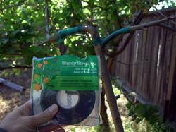
DSCI3793s.jpg

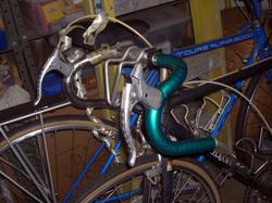
This is the stretchy plastic tape that I use to wrap certain kinds of grafts. What else can it be used for?

Up Highway 9

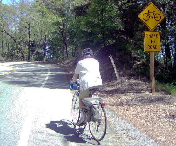
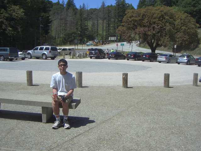
DSCI3781s.jpgElliot and I went up the Saratoga side of Highway 9 today. Not too much distance, but I’d estimate that it was the same amount of work that we would typically put in on a touring day. We will see no such hills on our actual trip – at least, I don’t think so. I used to ride this road just about every weekend when I was in my twenties. It’s 7 miles to the top, and an average 6% grade. When I was young, my best time was a little under 40 minutes. We took double that this time. I don’t feel bad about it. Slow and steady.

DSCI3782s.jpg

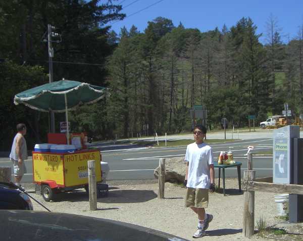
There’s a hot dog stand at Saratoga Gap (the top). This stand has been there for over 25 years. I remember it from my earlier days. The same guy is still selling hot dogs. Before him, there was an actual truck that parked in the lot, run by two hot girls. I don’t know what ever happened to them.

DSCI3784s.jpg

The hot dogs weren’t ready yet when we got there, so we waited 15 minutes for them to boil. Elliot had two hot dogs and two drinks I had one hot link and one drink. Total for everything was just $10

It was a fast descent, and then another 5 or 6 miles home. My allergies were bothering me a little, but it wasn’t too bad. My legs were tired when I got home. Elliot did not seem tired at all.

Bifurcation Number One


“Two roads diverged in a yellow wood…”

– from “The Road Less Traveled” by Robert Frost

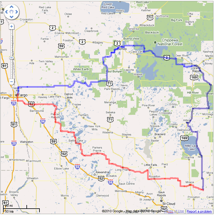
We haven’t even started on the tour, and already, we face our first route choice. Like which person to ask to the Prom, our choice will set us on a path that can’t be reversed without great anguish. And similarly, it’s not a choice between good and bad, but between good and good.

Choice1.gif

The Adventure Cycling Northern Tier Route follows the upper blue line. However, there’s also an alternate route in red. Much like life, both paths end up in the same place. Which do we choose?

Frost would probably have taken the road less traveled, in other words, the Alternate route. But what he doesn’t talk about in his classic poem is why the road is less traveled. Could it be that the road surface is crappy and full of potholes? Could it be that there are no shoulders, and huge trucks run you off the road? Could it be that there are no services? Could it be because it’s a boring highway with nothing to see? Maybe in real life, roads are less traveled because they SUCK!!

Google Maps helped me draw the picture above. And while I was there, I slid the Little Man along the lines to see what the actual place looked like in Street View. I took a random view about 1/4 way into each route, a view of a major town in the middle, and a random view at the 3/4 point.

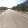
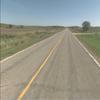
Here is the Standard Route:

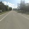
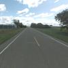
And, the Little Falls Alternate:

No help there, looks about the same to me. Both routes pass a lot of lakes, but oddly, these don’t show up in the street views. My guess is that Minnesotans are smart about not building roads on the waterfront, where they could flood or sink. The standard route is supposed to hit more wilderness, but again, you could have fooled me from that street view.

We could save 117 miles by taking the alternate route. That’s about 2 full days on bikes, days that could be used later in the trip. I’m also thinking that the standard route must have been plotted that way for a reason – they wouldn’t chart such a roundabout path unless there was something important to see along the way. Maybe it’s Lake Itasca, source of the Mississippi River?

What do you think?

Stuff I Gotta Do

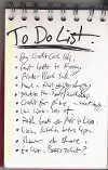
todo.jpg

This is just for my use. Move along, nothing to see here.

  • Passports – Roderick, Elliot
  • Go over maps, total up mileage
  • Flight arrangements
  • First Night’s lodging
  • Front rack cap nuts
  • Clean bikes
  • Get bikes checked
  • Sync Zoundry to netbook one last time
  • List of people to notify of blog: Clay, Julie, Gary, Huy, Mel, Work team, Platform team, home group, hostel group, Carol, Marilyn, Haruka, Bill, Ellen, Robert, solar friends pp314, Lois, Janet, Cindy, Susan & Marcus, Paul & Stephanie, Hawaii friends group, Jana & Phil Weaver, Kelly, Andrea, Reuben and Mitchell, Ralm, Wendy, Jethro, Elliot and Kendra’s friends, Huong, Terry Monaco, Mona, Vicky, Marja
  • Don’t forget, packing took all night last time
  • Laminate Adventure Cycling card
  • Make 5/16″ wrench
  • Brake cable on alpha bike
  • Load software onto netbook: activkey, gimp, modem driver, raven, trip documents folder
  • Find paper journal.
  • Collect Yahoo Dial numbers into a file.
  • Print out directions from Mackinaw City to Gaylord to Rose City to Bay City
  • Make calling cards.
  • Make your own carryon video.
  • Possibly make T-shirts.
  • Adjust Elliot’s rear derailleur
  • Fit mirrors on helmets.
  • Kung Fu shoes
  • Get or make bike boxes
  • Contact a church in Fargo
  • Flea Market – single AA LED flashlight
  • Get Laridian NIV bible for iPod
  • To order – brake hoods,4 sets brakes,handlebar wrap, Mr. Tuffy,chains,brake cable end
  • Put rear tire on Elliot’s bike
  • eBay G harmonica
  • Clean handlebars
  • Calibrate cyclometer
  • Test text-to-email interface
  • Tape handlebars
  • Look for water bottles.
  • Try fluid theme for wordpress
  • Activate and test TracFone
  • List of food and supplies to pick up on arrival – gas, coffee, oranges, deviled ham, bread, cookies, viennas, pop top vegetables, hot chocolate, money, shampoo.
  • Register blog on Adventure Cycling page
  • Link to blog on Angelfire page
  • Look at Google Maps for choices where route splits
  • Get credit union ATM locator for iPod
  • Scan instructions for tent assembly
  • Flea market – toothpaste

Tierra Bella – Apr 17, 2010

Yesterday (Saturday) was the Tierra Bella, an organized ride near Gilroy. We registered far in advance, for the easiest route (60 km), thinking we should go with an safe warmup for the season. 3 weeks ago, when Elliot and I rode 75 km to Santa Cruz, I realized that the short route of the Tierra Bella might be a little too easy. It was…

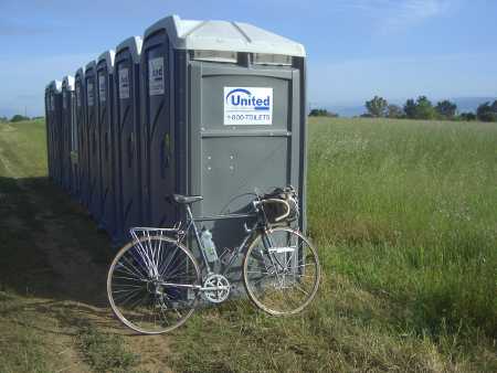
DSCI3765s.JPG

Ample toilets at every stop

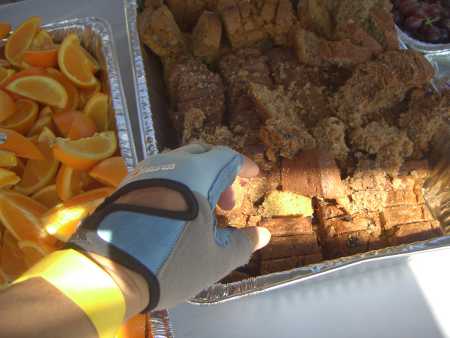
The Tierra Bella 60k turned out to be a be a beautiful route, following the flat grade of the Uvas reservoir for much of the way. There were toilets at every rest stop, and an assortment of good foods, including bagels, roll-up sandwiches, gorp, bananas, oranges, grapes, pineapple, energy bars, cup-o-noodles, hot and cold drinks, and home-baked breads.

DSCI3767s.JPG

Rest stop food every 10 miles or so

Elliot and Merrianne at lunch

We finished at about 1:00 pm, enjoying a delicious lunch of all-you-can-eat jambalaya on red beans and rice. They even had live music.

Live Music

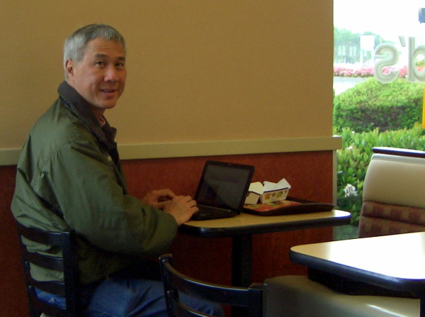
By the way, I’m timing myself on this blog entry. I want to get an idea of how long the laptop will be on per night on the real trip, and thus, how long the battery will last. Everything, from turn on, downloading pictures, reworking things with GIMP, and synchronizing to WordPress took 38 minutes. That includes 4 minutes of figuring out to the Cupertino public library network, and 3 1/2 minutes to actually upload everything. Afterwards, I moved to McDonald’s and tried the connection there. Only 30 seconds to upload the same thing. This could work!!

Blogging on a Bike Tour – and other IT burdens

DSCI3756s.JPG

How I plan to post updates

The last time I did a self-supported bike tour was 1988. On that trip, sending pictures meant mailing rolls of film back. Calling meant finding a pay phone, and paying an hour’s worth of minimum wage for 10 minutes. Way too expensive, except for a weekly check-in call to my sweetheart Merrianne (now my wife). Journaling meant writing by hand in a physical book. And writing meant filling out postcards. Technology has certainly advanced, making it possible for someone to give a frequent and very timely update to an unlimited number of people. Aka, a blog.

I still plan to do some postcards, and keep a physical journal. But to do the blog, I’m going to need some extra equipment. I think it will be worth it, and hope you will agree. We’ll see.

My digital camera

My camera is an older, inexpensive digital point-and-shoot The high-end cameras have big lenses, and are too heavy and bulky. The small and very slim new cameras actually take more space, because each of those needs its own custom charger. My camera uses ordinary AA batteries, the same as some of our other equipment. So if the batteries go dead, I can borrow a couple from the LED flashlight.
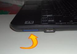
Built-in flash reader

The camera also uses a plain SD flash card, which conveniently fits into the built-in reader in our HP netbook.

Yes, we’re bringing a computer. If this were a car trip, I could bring a regular laptop with all kinds of accessories, but bike touring demands scrutiny of every ounce of cargo. Elliot’s netbook is optimal, providing a flash card slot, large storage, a full keyboard, and built-in Wi-Fi. Ten years ago, my choice might have been a Palm III PDA, with portable keyboard. But technology advances.
My plan is to upload the day’s pictures to the netbook, and compose blog posts offline using Zoundry Raven. Come to think of it, I might even outline what I want to write on paper first, to conserve battery life. It’s possible that we will go a few days without seeing a power outlet. When we get in range of a Wi-Fi connection, I will send the posts to the website, for all of you to see. If we can’t find a McDonald’s, public library, or a coffee shop, we may have to leech off a private household’s wireless. I’d ask them first, naturally.
Keeping in Touch

Twenty years ago, we would simply agree on a place to meet if we got separated on tour. Ten years ago, we would use FRS communicators (walkie-talkies). Today, the solution is obvious. Elliot, being a teenager, has a cell. As of this writing (4/13/2010), I do not. Well, not really. I got a TracFone, but haven’t activated it, yet. For $20, I get the phone, and 120 minutes of talk time, good for 90 days. If I need to add more on the road, I will. TracFone time is still expensive (60 minute card for $20), so my calls will be short, and mostly to Elliot when we are separated. Any extended chatting will be on his cell phone.
Wall-Outlet1.jpgThe Quest for Power

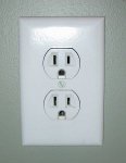
We take electrical power for granted at home, and even on vacation. Motel rooms have outlets. Anyone with a car or motorcycle can plug into the cigarette lighter for power. But what to do on bikes, when we are camping most days?

Right now, I’m thinking that power, not Wi-Fi access, will be our limiting technology factor. Sure, we can connect to the net at McDonald’s, but there won’t be outlets for us to plug into (I already scoped out a few to check). Will a Starbucks, or any coffee shop for that matter, have outlets available? Maybe we can plug in at a public library? I’ve already discarded the idea of bringing a solar panel (too big, hard to use), and attaching a generator to the bike (too much work).

Weird Stuff We’re Bringing

Like backpacking, self-supported bicycle touring is all about size and weight. It’s pretty common for cyclists to post their equipment lists. I could send you ours, too, if you really wanted to see it (it’s a 4-page spreadsheet). But here are a few of the more interesting items (okay, not so weird) in our packs:

Nylon straps to secure the tent and sleeping bag to the rack. Bungee cords are heavier, and can’t secure as wide a range of loads. Straps will make just about any cardboard box into a backpack, or a suitcase with a handle. Also, they can be worn as fashionable belts.

Gotta have chopsticks. They’re both eating and cooking utensils.

Tie wraps. If anything comes loose, they stand at the ready

See the little release tab on the latch of the tie-wrap? That lets us use them over and over again.

An iPod Touch. I don’t have an iPhone, but that would work, too. This is not so much for playing music, as to run a few handy applications, like an alarm clock and Bible. It’s also a quick way to get on the internet at a Wi-Fi hotspot.

If I’m going to carry an instrument, what could be lighter?

Kung Fu Shoes. Not to do martial arts or anything, but because they are simply the thinnest, lightest shoes for off-bike use, that can still pass for shoes. I could wear these into church or a 4-star restaurant, because nobody really looks at men’s shoes, anyway.

No GPS, intentionally. I want to interact and ask for directions. Also on the “no” list: pepper spray, air horn, weapons of any kind. Except of course, my Secret Illegal Ninja Moves from the Government.