Years ago, I had the notion that I would have to pay a surveyor to mark the corners of the lot before building. But then my friend reminded me that I have a GPS in my pocket (my phone), and Google Maps shows the lot boundaries.
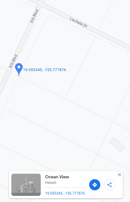
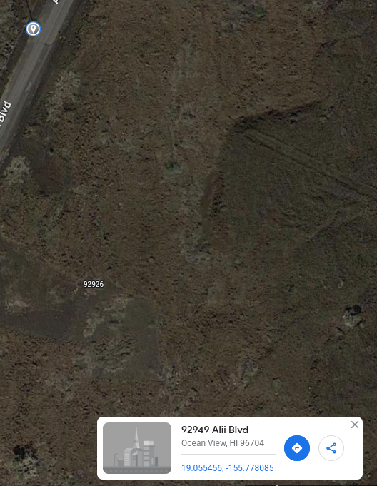
This is the north corner of our rectangular lot, which is tilted about 26 degrees off due north-south. Note the outline of our neighbor’s house in the adjoining lot to the east. The latitude is less than the Earth’s tilt of 23 degrees, meaning that this location gets Lahaina Noon (sun directly overhead) at some rare times of the year, and even sun coming out of the north.North corner again. Slightly different coordinates due to zoom and inexact positioning of mouse.West corner.South corner.East corner.This is the West corner in satellite view. I adjusted the brightness curves in Gimp for better visibility of terrain features (compare to satellite pictures below). The dark area to the northeast of the Google marker seems like a good location for a sun shelter. I don’t want to put a dwelling there, though. I want it in the dark area at the right of the picture, at the back of the lot, isolated. That area is actually on a small hill. The thing that looks like a road there is a bulldozer path at the lot line. It stops at the edge of a cliff.Looking closely, there are telephone poles across the street, roughly at the lot boundaries. I will first confirm their coordinates on the ground, then possibly use them as landmarks. This pole is across from the North corner.The pole across from the West corner.
Google Maps doesn’t seem to be the best tool for finding GPS locations while on the ground. I downloaded something called “GPS Data” for Android, which seems much better.